
Wireless telecommunication is a Capital Expenditure (CAPEX) heavy business. The majority of that CAPEX goes into constructing, maintaining and upgrading cell sites in their different flavors:
Tower sites: also called greenfield sites. These are locations on an empty plot where the erection of a tower (self support, lattice, monopole, guyed” is possible to allow antennas to be mounted to a certain height according to the Radio Network Planning to cover a certain area.
Rooftop sites: These are on top of existing buildings, the height is mostly predetermined by the existing building and the locations, directions of the Antennas and the amount of radiated power are often regularized by the government
Micro cells: these are street level coverage solution for a limited area, they are often wall mounted to existing buildings, or on advertising panels, light poles etc.
Once a tower site is constructed it requires regular inspections (usually on a yearly basis) and corrections of issues and through the site life cycle are often subject to expansions of existing technologies, introduction of new technologies and modernization that require re-engineering the structure and the site layout and parameters.
The traditional way for doing this has been to do climb audits where a technician climbs the towers and audits the state of the structure, the Antennas/Radios mounts and cabling etc. to produce a report that can be used by the engineer to recommend the necessary modification.
With the advent of Unmanned Aerial Vehicles (UAVs) or drones and LiDAR scanning technology, thermal sensors, a new opportunity presented itself to a lot of economical segments including the telcos and their towers. Now a drone can survey the tower and collect enough pictures and scans that, once post processed, allow the telco to build a highly accurate digital twin model of the tower site. This model can be centrally accessed by all the telcos engineers, planners in order to plan the next expansion or maintenance without the need to resort to the labor intensive climb audit.
Examples of drones capable of tower audits
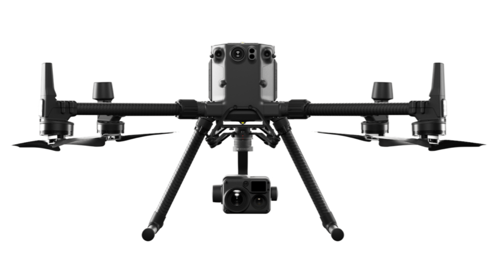
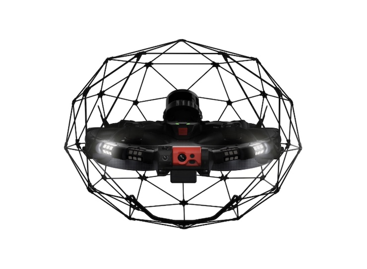
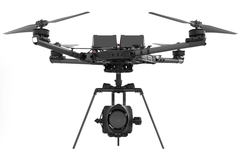
Of course the addition of the right type of sensors to these drones and their payload capacity, battery capacity and accurate flight control paths are some of the parameters that make these drones the most utilized in industrial settings.
Important figures for drone survey operation
Here are some aspects to consider for the way these drones are utilized today:
- The cost of these drones ranges from 15,000 $ to 50,000 $ depending on the make and the number of sensors.
- The flight time on a single battery charge is usually around 30 minutes at the lower end and up to 45 minutes on the higher end.
- Most drone surveys are piloted by licensed human pilots moving from tower site to the next with vehicles and a having a number of batteries to swap between drone lights.
- The cost of these drone surveys, cost between 500$ to 1000$ per site. This survey is often needed a number of times for the same tower: after initial construction, before and after expansions and upgrades and for maintenance and inspection, we can say at least once a year would be needed only for inspection purposes.
- High-end inspection drones, like the DJI Matrice 300 RTK, can reach a maximum speed of around 80 kilometers per hour. However, during detailed inspections, they typically fly much slower to ensure accuracy and stability, often around 10 to 20 kilometers per hour. That slower speed allows for better data capture and more stable imaging.
Autonomous drone survey system
It would make sense to have a drone system allocated to a cluster of nearby cell sites with the capability to be deployed autonomously and completing the cell tower survey and reporting back to the post processing team or automation to update the digital twin model.
The key challenges for this autonomous model is the following:
- Flight time limited to battery charge and the need for at least one battery swap to complete one site survey
- The drone needs to have the ability to swap batteries autonomously in order to complete the tower survey and have enough power to move to the next site and so on
- The drone needs to be able to move from site to site on its own, which can be predefined as pre-planned flight paths that are authorized with the relevant transport authorities.
To overcome the flight time and battery charge limitation some of the available solutions are:
- Drone docking stations with automatic battery swap
- Drone docking stations with charger
- Drone landing pads with charging terminals or wireless charging.
So the concept of an autonomous drone survey system can be defined with a few parameters, take the following as an example:
- Define a drone survey cluster including a group neighboring sites within a 5 km radius from one hub site location where the drone will be stored between survey campaigns.
- Every site in the cluster will have one drone docking stations or drone charging pads to allow the drone to recharge or swap its battery.
- A site to site path will be programmed by a human pilot in advance taking in consideration all transport authorities restrictions
- A site survey flight path is defined for each site based on the tower location in the plot.
Drone survey campaigns can be scheduled in advance, such as annual inspection of all sites or triggered by the publication of a planning specification for upgrade or inspection or simply manually.
Leveraging the power of Machine Learning in autonomous drone surveys
These drones can also leverage the power of machine learning (ML) in dealing with unexpected obstacles and flying conditions faced on the site to site flight path. Some of the examples of these ML applications are below:
- Obstacle Avoidance and Adaptive Flight Control: Machine learning algorithms, especially reinforcement learning, enable drones to autonomously navigate complex environments, avoid obstacles, and adapt to changing conditions in real time. For example, MIT researchers have developed adaptive control algorithms that allow drones to minimize trajectory errors even in unpredictable wind conditions, by learning from just 15 minutes of observational flight data
- Computer Vision for Object Detection and Inspection: AI-powered computer vision allows drones to recognize and classify objects such as power poles, insulators, or structural components of telecom towers. Advanced systems can autonomously fly around specific targets, capture images from consistent viewpoints, and detect defects like cracks or corrosion using convolutional neural networks (CNNs)
- Sensor Fusion and Real-Time Decision Making: Drones equipped with multiple sensors (cameras, LiDAR, radar, IMUs) use AI to fuse data and create a comprehensive understanding of their surroundings. This enables real-time path planning, accurate mapping, and safe navigation even in unstructured or unknown environments
- Automated Data Analysis and Reporting: AI algorithms process images and sensor data to automatically identify anomalies, quantify damage, and generate detailed inspection reports. This reduces human error, speeds up the inspection process, and provides actionable insights for maintenance teams
- Swarm Intelligence and Coordination: AI enables multiple drones to work together as a coordinated swarm, sharing information and optimizing inspection routes for large or complex sites. This is especially useful for covering extensive infrastructure or disaster zones efficiently
- Drone survey scheduling: Machine learning can analyze tower maintenance and deficiencies logs for related to geography, weather, age of infrastructure, type of structure, tower manufacturer and much more to detect patterns for preventive maintenance and schedule inspection visits in a timely manner and with the right prioritization.
Next Steps
A proof of concept of the autonomous drone survey system to be done for a telecom operator or a tower company to study the business case in more details and analyze the different capital and operational expenditures in traditional human audits versus autonomous drone surveys.

Leave a comment